


Student Pilot and PPL Training
Familiarize yourself with the VFR ICAO chart that you will use during your PPL exam.
Since 2021, PPL theory exams have been conducted using Rogers Data VFR ICAO charts. The “Navigation” and “Flight Planning” sections of the Aircademy ECQB-PPL question catalog exclusively use charts extracts from Rogers Data VFR ICAO charts.
Hint: Use the appropriate Rogers Data VFR ICAO chart (we recommend the 1:500,000 scale) from the start of your training, because you will need it for your exam at the latest!
Everything you need as a student pilot
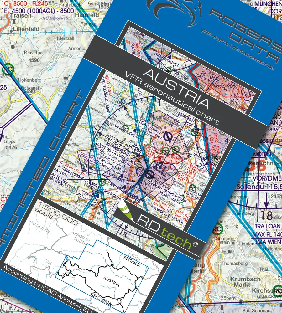
Austria
€ 24,90 incl. VAT
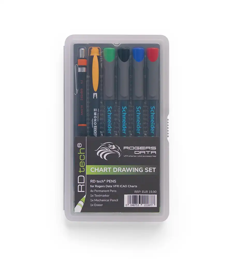
RD tech® Pens
€ 19,90 incl. VAT
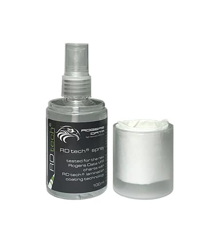
RD tech® Spray
€ 11,90 incl. VAT
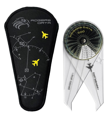
Navigation Compass 500
€ 34,90 incl. VAT
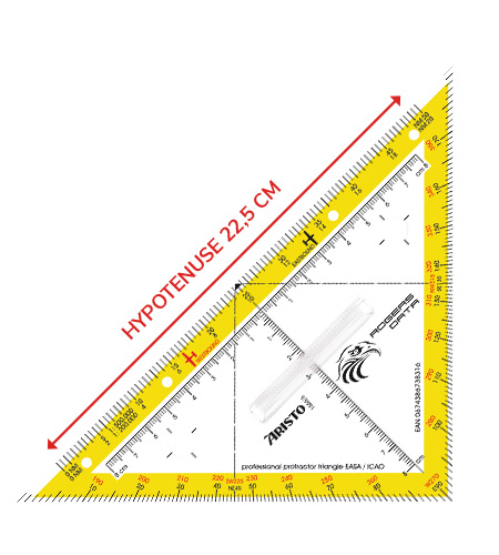
Protractor Triangle
€ 19,90 incl. VAT
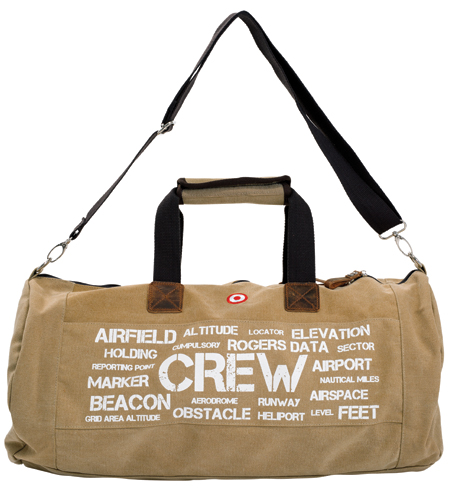
Aviation Terms Bag
€ 79,90 incl. VAT
Must have – RDtech® from Rogers Data
Rogers Data VFR ICAO charts feature a special coating thanks to our RDtech® technology. This makes the charts unique and more practical than ever. With this technology, all charts are virtually tear-proof and can be folded as often as desired. The special lamination minimizes sun reflection and glare and has been tested at temperatures between -20°C and +80°C. Rogers Data charts can be written on using an optimized permanent RDtech® pen set. The marked flight paths and markings can then be removed without leaving any residue using RDtech® spray or RDtech® cleaning wipes.
This is a huge advantage when preparing for a flight!

What aids are permitted for the PPL theory exam?
The Rogers Data Navigation Triangle and the Rogers Data Navigation Compass may be used in official theory exams. These two tools enable simple solutions to navigational route and time tasks and comply with the specifications for use in written examinations of the EASA / ICAO.
According to EASA, electronic aids such as programmable calculators or electronic navigation computers are NOT permitted in theory exams. This is formally stipulated in AMC ARA.FCL.300:
(g) Applicants may use the following equipment during an examination:
(1) a scientific, non-programmable, non-alphanumeric calculator without specific aviation functions;
(2) mechanical navigation slide-rule (DR calculator);
We therefore recommend that you use the Rogers Data Navigation Triangle and the Rogers Data Navigation Compass . A tutorial shows you the advantages of these Rogers Data Tools and how to best use them to solve navigational route and time tasks.

Navigation Triangle EASA / ICAO
With this professional, high-quality navigation triangle, you can easily measure distances in NM and courses on VFR charts. Scale 16 cm, with 0 point in the center (8-0-8) and additional scale in NM for the scales 1:200,000 and 1:500,000. Circle template 10 mm for left- and right-handed users shown. Its simple route planning and high user-friendliness make it the absolute favorite for pilots and skippers!
Navigation Compass
The Rogers Data navigation compasses 200, 250, and 500 combine a course triangle, navigation compass, and circle template in a single device. The Rogers Data navigation compass provides a simple solution for navigational distance and time tasks on maps with a scale of 1:200,000, 1:250,000, or 1:500,000. Make sure that the navigation compass matches the scale of the VFR chart!

ECQB PPL questionnaire
The ECQB-PPL is an international question database for private pilot licenses based on European regulations and standards and is also ICAO-compliant. It is available in several languages and is updated two to four times a year. As part of further standardization and harmonization of pilot training, from version 21.2 of the PPL database onwards, only ICAO charts from Rogers Data will be used in the subjects of flight planning and navigation. Exams at Austro Control and other aviation authorities have been conducted since October 1, 2021, using version (PPL R21.2.) and the corresponding Rogers Data map sections. The plant manual contains complex plants that may appear in the exam, including those from the unpublished section. It also contains the Rogers Data map excerpts.
VFR ICAO Charts
Always use current and suitable charts. VFR charts must contain the current airspace structure, the current frequencies and procedures, and the route relevant to the respective flight, including diversion measures.
There is no rule, regulation or law that requests that only certain certified charts or charts from specific suppliers have to be used. The opinion that only goverment issued VFR charts or charts issued by a certain authority may be used for flying, is not designated in the law. Furthermore, there is no rule regarding the form in which the latest chart material has to be present. The term „aeronautical chart“ refers to all sorts of maps used for air navigation providing some of the following information: topographic features, hazards and obstructions, navigation routes and aids, airspace, and airports.
Rogers Data VFR Luftfahrtkarten – ICAO Karten erfüllen diese Anforderungen und enthalten alle Informationen, die zum Fliegen notwendig sind. On one hand Rogers Data VFR charts meet the requirements of ICAO Annex 4 and European Commission Regulations and on the other hand meet the expectations of VFR pilots. We are able to combine the requirements and expectations of VFR pilots for VFR aeronautical charts and provide highly sophisticated and optimized products.
Charts contents
Rogers Data VFR aeronautical charts provide a highly detailed representation of the respective airspaces. The chart is based on a topographic map with shading and relief. This creates a dynamic 3D impression. The aeronautical charts include TMZ airspaces with mandatory transponder activation, RMZ zones with mandatory radio communication, airports, airfields, and heliports with detailed information. Furthermore, mandatory reporting points, reporting points on request, and border crossing points are included. In addition, radio navigation systems with name, frequency, and identification in Morse code.
Danger areas, restricted areas, flight restriction areas, aviation obstacles or groups of obstacles, air sports areas, areas with recreational activities, and nature reserves with aviation-related restrictions are also marked on the chart. In addition, Rogers Data VFR aeronautical charts are based on the latest aeronautical information from the AIPs (Aeronautical Information Publications). They comply with the relevant provisions of ICAO Annex 4 “Aeronautical Charts” and the relevant EU-Regulations.
Display of airspace structure
Rogers Data VFR aeronautical charts display airspace in an optimally legible manner and, thanks to the chosen display format, enable the identification of overlapping airspace boundaries. This facilitates the rapid comprehension of complex airspace structures, such as those found in areas with high traffic density and airports. Spatial visualization and comprehension of the airspace structure are optimally supported.
Color-coded airspace structure
Rogers Data VFR aeronautical charts show airspace that does not require clearance in BLUE and airspace that requires clearance in RED. Each defined airspace contains information on the airspace structure in ascending order from the ground up to flight level FL 125. Control zones, zones with mandatory radio communication, danger areas, and restricted areas are highlighted in RED to draw attention to their special significance.